The growth, demolition and rebuilding of the Gorbals in Glasgow is a troubled part of the city's history. During the 20th century the Gorbals was the beating heart of Glasgow. An area on the south bank of the River Clyde, near Glasgow city centre, the Gorbals became synonymous with poverty, overcrowding and the random violence of razor gangs made famous in the 1935 novel No Mean City.
The Gorbals started as a single street village to the south of a new bridge built in 1345 crossing the River Clyde. Five years later it housed a leper colony, dedicated to St. Ninian, for Glasgow's citizens. Merchant George Elphinstone feud the land from the church in 1579 and in 1650 the village was taken over by the City of Glasgow. At this time it consisted of thatched houses and its main industry was weaving. By 1771 the population had reached 3,500 and at this time Hutcheson's Hospital took ownership of the land to the east of the old village and developed it. The land to the west was sold by the Hutcheson trustees to James Laurie, who developed Laurieston to the west.
To the south three seams of coal were being exploited by the Govan Colliery, employing over 200 men and later the Govan Ironworks (Dixon's Blazes) was established alongside this. This then brought more industrialisation, railway lines and more people.
Carlton Place from the north bank of the River Clyde
Laurieston's development started in 1802 with the fashionable terraces that still look onto the river here. In the picture above of Carlton Place this building is now home to the Prince and Princess of Wales Hospice.
By 1930 the population of the Gorbals had risen to 90,000 people, served by 100 shops and 130 pubs. Little was done to maintain the decaying housing or to improve the overcrowding and poor sanitation. With one toilet to every three homes and a population density of 459 people per acre (modern suburbs have 30 people per acre) it was clear that something had to be done. It is generally accepted however that the plan chosen by Glasgow's city fathers was an abject failure. Their Comprehensive Development Area Plan in the early 1960s was brutal in its destruction of the old Gorbals tenements and the brutalist architecture chosen to replace it has since been largely demolished. Sir Basil Spence's Queen Elizabeth Square (or Hutchesontown C) became a byword for deprivation and neglect. Large swathes of slum clearances were left as empty gapsites for decades for a never built Glasgow ringroad, cutting communities off from each other. Those locals not rehoused locally in the 1960s and 1970s were dispersed to the new towns of East Kilbride and Cumbernauld or the Glasgow schemes such as Drumchapel, Castlemilk and Easterhouse.
For the last 15 years many of these 1960s and 1970s developments have been swept away. New Gorbals housing built with more imagination and on a human scale seems to be resuscitating this historic area.
My gran and grandad were born in the Gorbals. My mum, her brothers and sisters grew up on Crown Street before they were shipped out to the new scheme in Drumchapel. So I went out to have a wander about the Gorbals yesterday to see where they used to live.
Immigration
The Gorbals has always been home to many of Glasgow's new arrivals, both from Scotland and from abroad. My granny was born in 1915 in a flat on Gorbals Main Street. Her grandparents had come to Glasgow to look for work in the previous century from Ireland and from the Scottish Highlands, via Townhead and Partick on the way.
My grandad and his Hutchesontown classmates, some of them without shoes, about 1915
Her husband, my grandad, was born a few streets away at Sandyfaulds Street in Hutchestown. His grandparents had come to Glasgow to find work from Bo'ness (where they had worked in fishing) and from Kilbarchan (where they had been weavers). Glasgow was expanding rapidly in the 19th century with many impoverished people arriving from Ireland finding cheap accommodation and work in the Gorbals. Poverty and in some cases famine drove Italian immigration to Scotland in the latter half of the 19th century, particularly when a change in American policy reduced access to that destination.
The next wave of immigrants to arrive in the Gorbals were from Eastern Europe, mostly Jews escaping pogroms in Czarist Russia, Latvia, Lithuania and Estonia. Later Jews fleeing Nazi Germany arrived. In 1881 there were 225 Russians living in Scotland in total, by 1901 there were 5,000 mostly Russian Jews living in the Gorbals, and by 1939 10,000 Jews were living here. Difficulties accessing employment for these immigrants often led to them establishing their own businesses such as in catering trades, in clothing businesses or sales. From 1928 Glasgow had its own Jewish newspaper produced on Cavendish Street in the Gorbals and until they stopped printing it in 1992 my granny carried on getting the Jewish Echo regularly (latterly mainly to check the death notices for news of old friends).
My grandad in themiddle of the back row of the top photo with his friends
and at work in the middle of the front row
These photos above with my grandad include his friends Tony Verrechia, Alec Abraham, Ellis Bergson, Davie Sluglett, Nathan Zemell, Tony Caplan, Louie Freedman, Mo Sacklosky and he married a Donnelly of Irish descent. I think this shows how cosmopolitan a place the Gorbals was at the time.
Later many of the first Asians to arrive in Scotland settled in the Gorbals, some of them following the immigrant who had come before them in setting up businesses. Before the demolition of the old tenements throughout the 1970s there were 10,000 people of Asian origin living in the Gorbals and they too had started up their own newspaper, The Young Muslim. Like the Jewish community before them, this community moved outwards to other neighbouring areas with time.
Today even with the new housing stock being built, the Gorbals is still an area where many families live on low incomes and social housing has an important part to play in the regeneration of the area. Hopefully this will avoid the exploitation by slum landlords that some other nearby areas suffer from. New immigrants to Scotland are now settling here. Maybe that was why when I saw some bollards had been painted the "wet paint" sign was written in four languages, including Polish and French.
Carlton Place
I started my walk by crossing over the Carlton Suspension bridge, built in 1871, towards the graceful terraces of Carlton Court on the right which are now a hospice and Laurieston House on the left. James Laurie lived in the central house on the left hand terrace here. His plan to extend a gracious suburb southwards was never fully realised as the area became increasingly industrialised in that direction.
Carlton Suspension Bridge and Carlton Place at the far end
Behind Carlton Place lies another of the rare older buildings in the Gorbals to survive. The building below was the former stables and warehouse of the Clyde Shipping Company from 1880, which had a smithy at the front. The central block would have had a goods hoist at the top of it to raise loads in through the doors on the floors below (now windows).
Carlton Court warehouse and stables
In contrast to that building and going onto Bridge Street is Cumbrae House. It was built in 1937 as a showroom for Cowen's Ideal Trading Stamp Company with its art deco design.
Bridge Street Station
Before Central Station became Glasgow's main station, trains from the Glasgow, Paisley and Greenock Railway terminated at Bridge Street Station in the Gorbals. The original station was replaced in 1890 by the Caledonian Railways building below. The four arches in the middle led into the booking hall. When you come into Glasgow from the south by train you can still see where the old platform stood at the back of the building. To the right of this building was the Station Hotel, now flats, then across the road northwards again stands the former Commercial Bank of Scotland. The gap site to the north of that building once housed the original Bridge Street Station built in 1841, which had grand Doric columns fronting it. The modern, rather functional, Bridge Street Subway station lies diagonally south-east of this building and was originally opened in 1896.
Building of the old Bridge Street train station
Across the road from the Laurieston pub on Bridge Street lies the building of the former Savings Bank of Glasgow built in 1888. With its marble columns at the front and an impressive domed roof inside, it was once home to a decent Greek restaurant as far as I remember, but looks all closed up now. The tenement at the corner has an impressive octagonal turret.
Former Savings Bank, Bridge Street
Heading further south on Bridge Street (which becomes Eglinton Street) you would previously pass two old places of entertainment. First on your left you would pass the Coliseum, a music hall opened in 1905. It was converted to a cinema in 1925 and played the first "talkie" in Glasgow four years later, Al Jolson's The Jazz Singer. It closed in 1980 and the council bought it as part of their plans to cut a new ring road through the area. When this never came to anything the increasingly dilapidated hall re-opened as a bingo hall. The bingo closed in 2003 and six years later the Coliseum became another victim to one of those mysterious fires which destroy troublesome old Glasgow buildings and it was demolished.
Further on the lies The New Bedford cinema, now the O2 Academy, a 1932 art deco building which is in regular use again as a music venue.
Towards Eglington Toll
Continuing south past Cumberland Street and under a railway bridge you pass some four-storey flats with white harling. A plaque here marks the spot where Sir Hugh Robertson was born in 1874, composer, conductor, pacifist and founder of the Glasgow Orpheus Choir.
Eglinton Toll, Glasgow in 1917 and 2015
If you carry on beyond the southern edges of the Gorbals, underneath the M74 extension which now cuts through here, you are in the area which once housed a cavalry barracks just off Eglinton Street. The cavalry from here were brought into the town centre to clear the streets of rioters in 1848 with "repeated charges". Later the site here housed the Poorhouse for Govan Parish. Eglinton Toll, once called St Andrew's Cross, is home to The Star Bar and, from 1922, the long gone Plaza Ballroom. Looking back northwards from here I took this photo to show how recognisable it still is from the picture of 100 years ago. The chimneys on the right at the St Andrew's Works are now gone although the rest of that building still stands, empty. It was built in 1899 as an electricity generating station and in 1937 was converted into a printing works. For me as a child it was always the thing that you saw on May Day marches towards Queen's Park that let you know you were coming to Victoria Road and were almost at the park.
St Andrew's Works, Glasgow
Gorbals Main Street and Gorbals Cross
From here I turned down Pollokshaws Road, passing the red sandstone building of the former Chalmers Free Church in the direction of the Brazen Head pub. Turning left into Cumberland Street you can find the entrance of another of the Gorbals train stations here. The elevated railway here was built between 1864-1867. This four platform station, originally called Eglinton Street Station, then later Cumberland Street Station was closed in the 1960s.
Cumberland Street Station
Just south of Cumberland Street a grid of tenement lined streets was swept away and replaced by the year 1973 with Stirlingfaulds Place. Two overbearing and unappealing 24-storey blocks with 552 flats stood here. Thirty-five years later, in 2008, they were demolished and now new flats are taking their place, modern three and four storey flats, built on a grid system, and on a human scale.
New housing replacing Stirlingfauld Place
Just east of the Stirlingfauld Place flats lies what remains of Gorbals Main Street. Only one lonely old tenement building still stands here at 162 Gorbals Street. This formerly housed a branch of the British Linen Bank Company and their logo can still be seen above the door. When my great grandad retired and left his flat at Gorbals Cross a hundred yards further north, he and my great-granny moved into this block. Every time that I pass it and see that it is still standing I feel my personal link to the Gorbals. Unfortunately I fear that it will eventually succumb to one of those mysterious Glasgow fires which happen in uncared for buildings. However I am hopeful that with new flats approaching it from the rear that it can be refurbished and saved for the future.
162-166 Gorbals Street before redevelopment began
162-166 Gorbals Street, Glasgow in 1970s
162-166 Gorbals Street, Glasgow in 2015
British Linen Bank Company, Gorbals Street
Gorbals Street, looking north 1965 and 2015
Looking north up Gorbals Street from here towards the city centre today it is hard to imagine that this was once the commercial, thriving heart of this community before the wrecking balls were brought in. The changes that have taken place amount to vandalism. On the the left and right stood long rows of tenement flats and shops. The Gorbals Public Baths were on the left. How much more grand would the Citizen's Theatre be today if they had kept the colonnaded frontage of the Royal Princess's Theatre as well as its handsome auditorium? This theatre was built in 1878. The columns which you can see in the old photo were salvaged from the Union Bank on Ingram Street and moved here in 1878. The figures sculpted by Mossman for this new building atop the columns are of Shakespeare, Robert Burns and Four Muses. They were moved inside when the facade was demolished, along with the neighbouring tenements and Palace Theatre, in 1977. The Palace Theatre next door had been converted into a cinema in the 1930s and later into a bingo hall. The Citizens Theatre Company was founded in 1943 and based at first in the Old Athaeneum before moving to the Princess's Theatre in 1945. Working as a joiner in the Gorbals, my grandad sometimes helped build stage sets here.
Beyond that, Gorbals Cross was drawn up in 1872 following the contemporary Paris fashion with the buildings set at angles to create a diamond shaped plaza which had a drinking fountain and clock at the centre. The tenements at the north-west corner of Gorbals Cross were designed by Alexander 'Greek' Thomson.
In about 1910 my great-grandfather gave up the idea of joining the priesthood, married Isa MacPhee. He moved from Saltmarket to a flat at 89 Mains Street on Gorbals Cross. It was here that my granny was born 5 years later and it was from this flat that my great-grandad worked as a dentist, despite not having any formal dental qualifications. The 1921 Dental Act tried to regulate the profession. From that time he was allowed to formally be registered as a dentist having worked "for at least 5 of the last 7 years as a dental mechanic as the principal means of livelihood". My granny tells me that here he made gum shields for local boy Benny Lynch and that the Socialist John MacLean had held meetings in their front room at Gorbals Cross.
Gorbals Cross
Gorbals Cross, later image
Just north of Gorbals Cross stood a tenement on Muirhead Street, now beneath the Central Mosque building, where Allan Pinkerton was born in 1819. A cooper to trade and active Chartist he emigrated to America in 1843 where he was working with slavery abolitionists within a year. He soon set up his detective agency, with an eye for its logo, giving us the world's first private eyes.
Crown Street
Just east of Gorbals Main Street my grandad was working as a joiner and cabinetmaker when he married my granny in 1938 and they moved around the corner into Crown Street. This long street ran parallel to Govan Main Street but was swept away by the 1970s re-developments.
My grandad's Gorbals joinery business
Crown Street has now been rebuilt in the first step of the attempt to regenerate the Gorbals with a new street network and with tenement style housing. My grandparents lived at 182 Crown Street, which was on the west side between Clelland Street and Rutherglen Road. They lived above Massey's shop. Alexander Massey's first grocer's shop was opened on Crown Street in 1872 as competition to Sir Thomas Lipton and he had soon opened shops all over the country. Although Crown Street is no longer crossed by Clelland Street, by my guess this puts their old flat roughly where Gorbals Library now stands at 180 Crown Street.
Massey's shop on Crown Street, Gorbals, Glasgow
Crown Street, 2015, with Gorbals Library on the right
New Gorbals Park and the view north from here down Crown Street. 2015
Just around the corner from the southern end of Crown Street stand some of the most striking buildings in the new housing development. Opposite the Alexander 'Greek' Thomson designed Caledonia Road Church hangs a bronze sculpture by a group called Heisenberg, "The Gatekeeper". It is suspended above an illuminated photograph and is meant to represent the Gorbals being on the cusp between demolition and reconstruction. It has also become known as "the angel with the bleeding hand" after a crack in the bronze of her hand causes rainwater to seep out a reddish brown colour. Aluminium figures project above the doorways of these flats. Called "The Attendants" they are meant to represent "an emotional response to the diasporal flux of people through the area over the past 200 years". Unfortunately if I pass these buildings on the way to Hampden I just can't help seeing it as a dozen people being tortured by "strappado" suspension.
"The Gatekeeper" sculpture
"The Attendants"
Alexander 'Greek' Thomson's Caledonia Road Church
Across from these buildings at the foot of Cathcart Road stands the sad remains of the Alexander 'Greek' Thomson designed Caledonia Road Church. Built in 1856, along with a row of tenements running behind it, it is a building of international significance, now just an empty shell. It's Ionic columns stand like the Parthenon on top of a solid base, with a sturdy tower standing beside it. Sadly the Greek Thomson designed tenements behind it were demolished and still languish as a gap site. The church closed its doors in 1963 and was bought by Glasgow District Council. Two years later one of those mysterious Glasgow fires gutted the building, destroying Thomson's colourful interior and the building had to be partially demolished. That is how it still stands, high on the "buildings at risk" register.
Before and after. Thomson's Caledonia Road Church
The former site of Southside Train Station lies opposite the church to the south. Since 2014 this has now become the "Caledonia Depot" and administrative headquarters of Firstbus.
Old weighbridge at Cathcart Road/ Laurieston Road junction and Firstbus depot
Southern Necropolis
Heading south from here and turning left along Caledonia Road you will soon come to the Southern Necropolis. The large empty wasteland to the west of the graveyard here was the site of Dixon's Blazes iron works and Govan Colliery. The coal fields here were "putting out 20,000 loads of coal per year" from 1713-1734. When William Dixon became the colliery manager he soon rose to become its owner and in 1801 took over control of Calder Iron and Coal Works. He created Glasgow's first ever railway here in 1811, a horse drawn cart initially taking coal to the short lived Glasgow Paisley Ardrossan canal at Port Eglinton. A railway pioneer, the extensive network of lines he developed to transport his coal and iron curtailed Laurie's plans to expand his Laurieston development. In the 19th century the furnaces here glowed day and night and the company continued to produce iron here until 1958.
The entrance to the Southern Necropolis caused me an existential crisis with signs saying "Welcome to the Southern Necropolis" alongside signs saying "Danger Keep Out". Presuming they actually meant "keep off" the crumbling gatehouse, built in 1848, I decided to enter. The Southern Necropolis has over 250,000 burials within it and replaced the older, overcrowded Gorbals burial ground which lies north of here. In 1841 children under 12 accounted for 57% of the burials and adults aged over 60 years only 2%. It contains the graves of many of the great and good of Victorian Glasgow. The city council has a heritage trail available with more information. There are here found the graves of Allan Glen who founded the school which bears his name lies here, Robert Paterson who manufactured Camp Coffee in Glasgow, Charles Wilson, the architect of Park Circus and "Wee Willie Whyte" a well known street musician who died in 1848. There is also the grave of Sir Thomas Lipton, who was born in 1848 on Crown Street. His parents were Irish immigrants who started running a shop selling ham, butter and eggs at 11 Crown Street. After spending several years at sea he returned to Glasgow and helped his parents run their shop before eventually setting up his own shops, which became a chain of stores throughout Britain. He became involved in importing tea from Sri Lanka/ Ceylon and the Lipton's brand of tea is known throughout the world. He became a multi-millionaire and bequeathed many of his yachting trophies and other items to the City of Glasgow, some of which are on display in Kelvingrove Museum.
Tomb of Alexander 'Greek' Thomson
Alongside Charles Rennie Mackintosh, Glasgow's most renowned architect is undoubtedly Alexander Thomson (1817-1875). He is buried in the Southern Necropolis and as his gravestone had been lost to vandalism, it was replaced in 2006 with a tombstone of black, Irish granite which sits incongruously amongst all the old, weather-beaten headstones here.
Southern Necropolis, Glasgow
The White Lady
One other gravestone worth passing is known as "The White Lady". Here lies John S Smith, carpet manufacturer, his wife Magdalene and their housekeeper Mary McNaughton. His wife and housekeeper were sheltering from the rain under an umbrella when they were returning from church in October 1933. They walked in front of a tram on Queens Drive and were both killed. It is alleged that the head of the veiled lady on the stone turns to follow you as you walk past, and glows gently at night.
Oatlands
Heading north towards the Clyde from the Southern Necropolis takes you through the area known as Oatlands, where housing redevelopment is well advanced, although not without some argument. The last of the old red sandstone tenements of this area have now been demolished in a controversial land deal.
Before you get to Oatlands you come to the former Fransciscan Friary and St Francis' Church in Hutchesontown. It has now been converted for use as a community, learning and arts centre. The Fransciscan Friars bought land in Hutchesontown here in 1868 and construction of the current church building was started in 1870. Although they probably want to keep quiet about it now, the building was officially opened in its new role in August 1998 by Bailie James Mutter and a certain Sir Jimmy Saville.
St Francis' Centre
The streets of the Oatlands development have many imaginative examples of public art scattered amongst them. One of my favourites is Gorbals Boys by Liz Peden, a sculpture re-creating a well know Oscar Marzaroli photograph taken in 1963.
Gorbals Boys by Liz Peden (and a modern day Gorbals boy)
Untitled (Girl with Rucksack) by Kenny Hunter
At the northern end of Oatlands the St Andrew's Suspension Bridge leads into Glasgow Green. When this bridge was completed in 1855 it replaced a ferry across the river for workers passing between Hutchesontown and Bridgeton. From 1885 the area of Oatlands near here was dominated by the massive United Co-operative Bakery building until it was demolished in the 1970s.
St Andrew's Suspension Bridge
Whisky, St Valentine's Bones and Benny Lynch
Heading back towards Ballater Street from here you will pass the Strathclyde Distillery which has been producing spirits here since 1928. Its smoking chimney just south of the river will be familiar to anyone who has passed through Glasgow Green. Glasgow's first (legal) distillery stood a couple of hundred yards from here in the Gorbals, underneath where the Sheriff Court now stands. William Menzies built it there after being granted Scotland's fourth licence to distill spirits in 1786.
Strathclyde Distillery, Gorbals
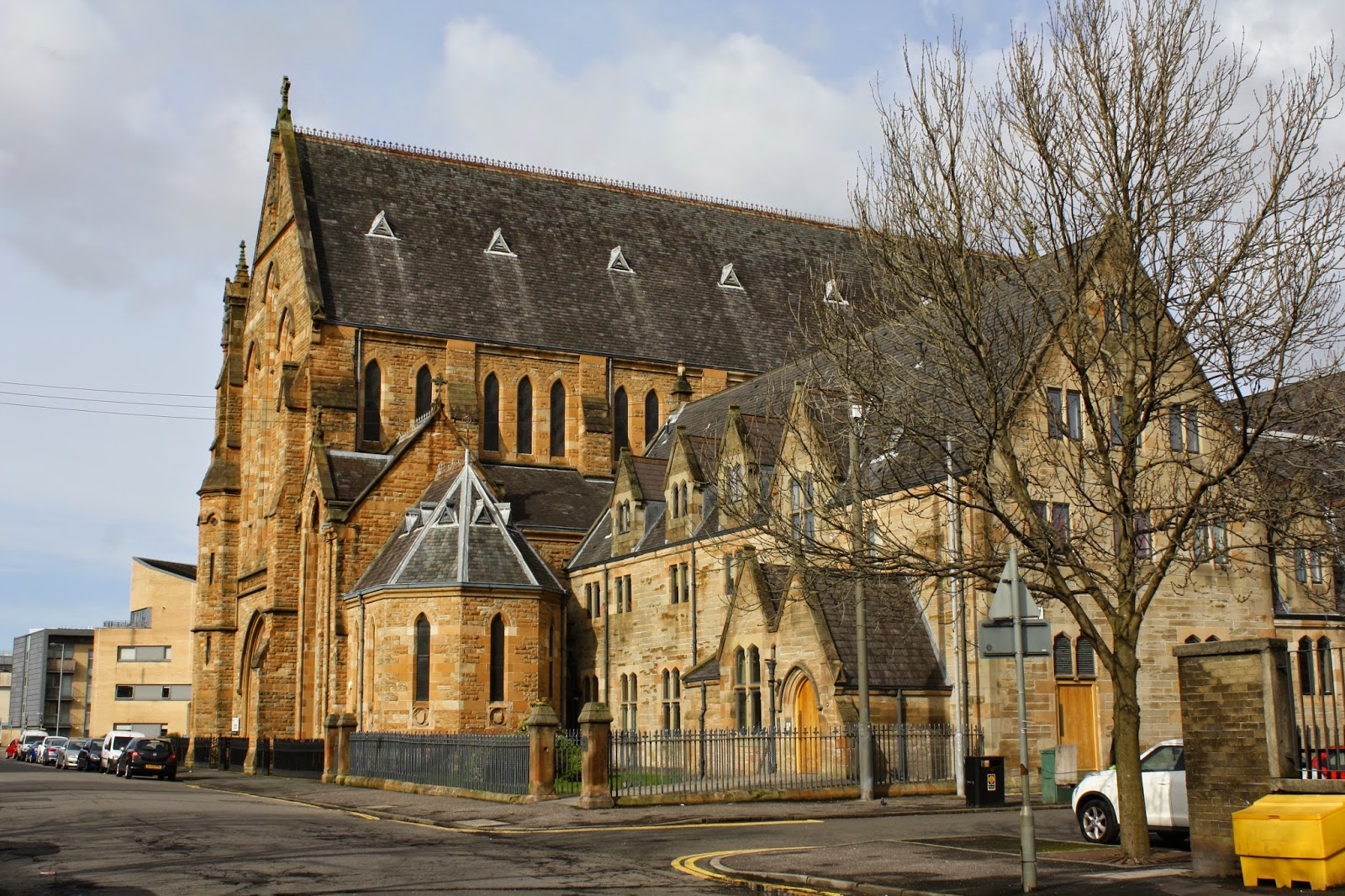
On the south side of Ballater Street near here is Blessed St John Duns Scotus Roman Catholic Church. Completed in 1975 this church shaped like the prow of a ship is now home to the Franciscans and is the only remaining Catholic church in the Gorbals. Like St Simon's church in Partick which continues to hold mass in Polish, they still maintain the tradition here of holding a monthly mass in Lithuaninan.
Bones of St Valentine in Glasgow church of Blessed St John Duns Scotus
South of the church the jagged roof of a former cotton mill, built in 1816-1821, towers over this area. In 1824 an industrial dispute here led to the shooting of two people on Ballater Street. Now called The Twomax Building it houses social work and healthboard services. A little sculpture of a cloud of smoke, by Rita McGurn and Russell Lamb, stands atop the chimney as a reminder of the previous industry here.
Twomax Building, Gorbals
I have previously tried to retrace the footsteps of one of the Gorbals most famous residents, world flyweight boxing champion Benny Lynch. The son of Irish immigrants he was born in Ballater Street and lived and trained around this area for much of his career. He is remembered in the name of a short street here, Benny Lynch Court, but I think his achievements merit something a bit more than that, no?
Benny Lynch Court
Just south of Benny Lynch Court lies Gorbals Rose Garden, the former Gorbals Burial Ground. Some of the old headstones remain around the walls of this green space. Several have no words, just the tools of the trade of those buried below, such as a baker's crossed "peels", long shovels for lifting bread in the ovens, or a collier's picks.
Old gravestones, Gorbals Burial Ground
Old gravestones, Gorbals Burial Ground
Glasgow Central Mosque and the Sheriff Courthouse
Coming north-west towards the river from here you will pass the campus of Glasgow College of Nautical Studies, now a faculty of the City of Glasgow College. Carrying on in this direction brings you to two modern Gorbals buildings. The Sheriff Courthouse on Gorbals Street at the riverside was built between 1980-1986 and contains 21 courtrooms. It is apparently the second largest courthouse in Europe and deals with more minor offences, serious offences being dealt with just across the Clyde at the High Court.
Glasgow Sheriff Courthouse
Across Gorbals Street from the courthouse lies Glasgow's Central Mosque and Islamic Centre. Completed over 30 years ago now in 1984 its illuminated dome is a familiar sight in the riverside skyline of Glasgow. Walking past it today I was surprised how small it actually is. Given the large numbers of Muslims there are living in Glasgow now maybe some jealous glances are being cast towards the two large Gurdwaras that have recently been built in the city.
Leaving the Gorbals I walked back across the Clyde via Jamaica Bridge (or Glasgow Bridge to give it its proper name). Passing here you can see the granite piers on which once stood the old railway bridge into the original Gordon Street Station (now Central Station).
Artist Ian Hamilton Finlay has carved words on the Dalbeattie granite columns. It reads in Greek and English "All Greatness Stands Firm In The Storm", a version of a phrase from Plato's Republic.
Only time will tell if the destructive storm of 20th century developers managed to flatten the Gorbals. From walking about the area today it certainly looks like things are finally moving in the right direction. However the infrastructure is only ever part of the answer. The availability of jobs and opportunities for the people living there is going to be just as important for the new Gorbals to become a thriving community again. This was overlooked when Glasgow's peripheral schemes were laid out in the 1960s and hopefully lessons have been learned from that.
Really good information.....just to let folk know that we are holding the very first Gorbals C`Mon Get Aff bus tour on Saturday 22nd October, setting off from the St Francis Centre at 1.00pm and finishing around 3.30 for a condensed tour of the Southern Necropolis. Tickets are £7.00 each and available from Colin and Elsie at the SN gatehouse (every Sunday from 12.00 till 2.00pm) :)
Amazingly detailed article you have here! It's great to have such easy access to the history of this wonderful place. One question though. Could you please tell me where you got the data for the populations and densities. I ask, as a density of 459 per acre seems to be extremely high
It was very high, that was the problem. This number is quoted in several sources, including the book "Urban Problems and Planning in the Developed World". Link - https://books.google.co.uk/books?id=j3G3AwAAQBAJ&pg=PA209&lpg=PA209&dq=gorbals+population+459+people+acre&source=bl&ots=gQahlC2mxJ&sig=UFWZzmYcStA09M7SXJud4POR_qA&hl=en&sa=X&ved=0ahUKEwi-k6f30_HTAhXLC8AKHWG7AGEQ6AEIRjAE#v=onepage&q=gorbals%20population%20459%20people%20acre&f=false
I don't know Glasgow and have never visited the city, but watching the old film "The Gorbals Story" on Talking Pictures TV recently led me to search for images which, in turn, pointed me to your site. Excellent photos and a very informative commentary - thank you! I am a fan of "before" and "after" photos and yours are very good.
Interesting, too, to look at an old image of the city centred on the church on Cathcart Rd and compare with a wide 3D oblique image of the same church via Google Streetview. A very graphic demonstration of the regeneration of the area.
Thank you very much for your story on The Gorbals. I am an adoptee in Warburton Victoria Australia. A month ago I was in Glasgow and Scotland for 5 weeks visiting the places where my birth family came from. On Sunday my cousin and I did a Census check of my Stewart family only to find out they were residing in Main Street Gorbals in 1851 before they set sail for Australia. It seems the mother stayed or died not sure yet. Oh I wish I knew about this before I came over but thanks to your most helpful site I know where to visit when I next come to Scotland. I felt so at home there. Thank you
The only thing I can find is a 1939 picture of 57 Bridge Street, when the new Co-operative building occupied the plot. From "Virtual Mitchell" website http://www.mitchelllibrary.org/virtualmitchell/image.php?i=11674&r=2&t=4&x=1
Fabulous article, an engaging read. I read this with interest, my grandfather was born and raised in Sandyfaulds St but up to now have found only fleeting references to the street.
He’d have been of a similar age group as those in the class photo, assuming it was taken c1915. Do you know the name of the school? There’s a face which looks familiar to us in that group and acknowledging it’s a long shot, wondering if you have the names of those in the photo to confirm or disprove? Thanks.
Thank you for an informative and detailed article. I walked around parts of the Gorbals today.. I'll be going back now with new things to look out for. Thank you
My family are from the gorbals and oatlands, The details in this piece of work is fabulous,just amazing, I took a walk with it as I was reading it. My old stomping grounds. Thank you.
How I would have loved to have been alongside you on your journey. I was born in Bedford Street. My Stewart's were also weavers in Kilbarchan. We seem to have much in common. Thank you for the memories. Margaret Green nee Stewart.
any information about Hospital Street? My Mum was born at number 130, in 1910. A niece recently visited there and thinks it is now under a new roundabout, but would love to have a photo of the place as it was. Gillian
Gillian, what is currently called Hospital Street, is not in the same position as Hospital Street in 1910. In 1910 it ran south from the Clyde, parallel and between Gorbals Main Street and Crown Street ( https://maps.nls.uk/view/75650655 ). If you check the old post office directories ( https://digital.nls.uk/directories/browse/archive/86474643 ) 130 Hospital Street in 1910 was between Cleland Street and Cumberland Street, on the right hand side as you head south. This row of houses would have backed onto the train line which is still there, although the old Hospital Street lies under Laurieston Street at this point now. On google streetview today, the house would have been about here https://www.google.co.uk/maps/@55.8488178,-4.2532429,3a,75y,262.54h,86.52t/data=!3m6!1e1!3m4!1sG6h0wrKmexMCQ4qnVQ9qeA!2e0!7i13312!8i6656
If you look at this webpage, near the bottom there is a 1960s photograph of this side of Hospital Street, and your 130 would have been one of these, towards the right-hand side -> http://www.scotcities.com/gorbals/hutchesontown.htm
Cowan's lived at 180 Hospital St, the close next to Tommy's Dairy, Mum, Dad, Sister and me, were in the top flat, my Grandparents in 2nd floor, and Uncle and Aunt in the one of the close flats, I remember getting a pennies worth of broken fish from the Chippy in Cumberland street, Great area, and people, despite the conditions
What an informative piece......fabulous! I have just found out that my family lived at 241 Thistle street in 1956 (McGibbon) and wondered if anyone could sign post me to some archive photos around that time
I was born at 271 Cumberland Street in 1942. While your narrative is informative, and probably accurate, it does not nearly describe what I lived through from 1942 to about 1951 when we were re-locate to the new housing scheme, Pollok. That seemed like heaven at the time. But I understand that Pollok went down the drain like the Gorbals shortly thereafter. We emigrated to the US in 1958, THANK GOD.
My mother was born in Norfolk Court in 1927. I have been looking at maps trying to pinpoint the exact location. She and her siblings were orphaned quite young and split up. She eventually came to England to join the Women's Land Army and sadly never returned to Glasgow before she died. I am hoping to visit this summer and would really like to find the best places with pictorial history of the Gorbals/Laurieston in the 20s/30s. Can anyone help?
Thank you for some great photos and the fascinating story of the Gorbals and surrounding area. Brought up in Clarkston, I have many great memories of my father travelling into Crown Street to buy our first black and white television from Stirling Hunter’s Shop. He became great pals with Mr Hunter and the local car dealer Archie Horsley who lived on the South side. Back in the late 50’s, early 60’s, my Dad was a regular visitor to Archie’s small used car showroom which was situated just a few yards before the left turn from Cathcart Road into Devon Street. I often remember those days as I drive passed the exact spot on the open ground at the First Bus stop where drivers often changeover under the new M74 flyover.
Looking at photos of Caledonia Road where the Reid family stayed ( my grandparents) also had a greengrocers shop in Moffat Street,I can remember going up to a 1 bedroom flat and it being very dark and jumping on a bed in a recess of a room,also the shop had 1 arm bandit in it ,my Aunt made tablet and other thing for the shop to sell,different days
Hi enjoyed your article, I came across it because I was trying to find out where exactly old gorbals cross would be in today’s time? My mum had a photo of gorbals cross with Arthur blacks shop and the toilets 8n the middle of the road.....wondered if that was the same place as where ballater st and crown st cross over today? Can you help? Thanks Laura x
Gorbals Cross was the next street along from Crown Street, where Ballater Street and Gorbals Street met. It had a diamond shaped junction with a clock atop a drinking fountain, and a toilet in the centre of the junction.
Thank you, I will try to get the bearings, it’s hard , as you know it’s all changed and I’m not good with direction in the first place, ...my mum was born and lived in 9 Kames St gorbals ...and I can’t find anything , photos either of there, keeps coming up with James st. But that’s not it....🙄 thanks again x
What an excellent piece of work. Passed on this link to my son who has been living in Glasgow for about 10 years now. Mysterious fires in empty buildings. This seems to be a common theme in many areas of Scotland. Here in Falkirk it was empty schools that burned down.....the land then quickly sold off for housing development, what a co-incidence eh !!!!!! Stephen a Falkirk Bairn with Ancestral Roots in Glasgow.
Refer Old Gorbals Cross:If you walked east from there then the first street to bisect Ballater St would be Hospital St then Thistle St then Crown St.These three streets more or less running parallel with Gorbals[Main St]To the South of Caledonia Rd there is still a length of road identifiable as Thistle St junctioning with Cathcart Rd
What a fantastic article, thank you so much for this. My father was born in 1923 at 400 Cumberland Street and his parents and grandparents all lived in and around those streets, I wish I could have seen it before the redevelopment. I was also very interested and sad to read about the 'mysterious fires' which befall old buildings that no one can be bothered to try and save! It happens a lot here in Hull too. Most of our architecture was bombed by the Luftwaffe but what they didn't manage to get, the council have demolished and of the few bits left here and there, mysterious arson attacks are working their way through!
Very interesting! My mum lived in the tenements on Cromwell Street in the 50-60s, with her parents and five brothers. I had a visit some years ago. There are modern flats there now, but at the end of the street remains an old school. It was converted into a community Center. Across the road there was still a grassy area. I have some photos of how it was. Was Cromwell street a part of the Gorbals?
Hello from America! My ancestors were from the Gorbals area and I see the photo of the classmates in abt 1915 in Hutchesontown. Alot of my Sweeney/ Swan ancestors were born there. I am wondering what school the photo was taken at and if you have any names of the classmates? Thank you :D Great job & I love your site!!!
I don't know any more than that. My grandad is in the photo, Duncan Speirs, but as I was given it after he died I wasn't able to ask anything more about it. Sorry.
What an informative and fascinating account of the Gorbals. Thank you so much! It's many years since I knew the area, and remember it as it was. Around 1970 I played the organ at the Old Rutherglen Road Church of Scotland. That's disappeared now. I used to travel on the 37 bus to Castlemilk and that used to go the length of Crown Street. That's gone too. The prestigious "Hutchy" Boys School, Hutcheson Grammar used to stand, dark and sombre, on Crown Street. I wonder if its old boys used to admit to going to school in the Gorbals. I'm sorry that Glasgow doesn't seem to care for the treasures of its past. The Alexander 'Greek' Thomson church should not be left to stand in such forlorn isolation as the photo here shows.
Well, it's nearly 7am and I've just spent quite a few hours looking up info on the Gorbals, culminating with your wonderful description above. I've known for a while that I have Irish ancestors, but only yesterday discovered that they came to the Gorbals from County Leitrim during the Great Famine, poor souls. As I have only once passed through the Gorbals - at night, in a car, being driven to Queen St station, c.1975 - I had no idea of its history. I feel that I now have a better understanding and I'm encouraged to learn more. Thank you so much!
Greetings from Canada! I have family roots in the Gorbals, and have learned a lot from this excellent piece. I'm interested to know if anyone is offering guided or self-guided tours of the area, either from a social history or architectural history perspective.
My mother was born in the Gorbals ,Jean Taylor. Mother nee Christina Baker, Father Richard Taylor, returned from WW1 . He made and sold wooden toys in the Gorbals. I am looking for the photo on a staircase of a group of children. It was a professionally taken one according to my mother
Fantastic report. My grandfather is recorded as a bonded warehouseman on his marriage in 1901. he lodged in 3 Govan St.1901 56 Rosebery St 1905 have tried to locate a distillery in area without sucess, could you advise thanks
My grandfather, James Donnelly, who died before I was born lived in the Gorbals and was a publican. I am trying to trace the name of his pub. My father is 96-years-old and suffers from memory loss. My grandfather would have lived in the Gorbals between 1926 and the mid 1950s. He was an honest publican who hated having to pay extortion monies to one of the gangs blighting the area at the time. If you have the name of the pub, I’d be delighted to have it. Thank you.
Due to the volume of spam which some posts attract, all comments are moderated, which may cause a delay before they appear. Thank you for your patience.


.jpg)


 Across from these buildings at the foot of Cathcart Road stands the sad remains of the Alexander 'Greek' Thomson designed Caledonia Road Church. Built in 1856, along with a row of tenements running behind it, it is a building of international significance, now just an empty shell. It's Ionic columns stand like the Parthenon on top of a solid base, with a sturdy tower standing beside it. Sadly the Greek Thomson designed tenements behind it were demolished and still languish as a gap site. The church closed its doors in 1963 and was bought by Glasgow District Council. Two years later one of those mysterious Glasgow fires gutted the building, destroying Thomson's colourful interior and the building had to be partially demolished. That is how it still stands, high on the "buildings at risk" register.

 The entrance to the Southern Necropolis caused me an existential crisis with signs saying "Welcome to the Southern Necropolis" alongside signs saying "Danger Keep Out". Presuming they actually meant "keep off" the crumbling gatehouse, built in 1848, I decided to enter. The Southern Necropolis has over 250,000 burials within it and replaced the older, overcrowded Gorbals burial ground which lies north of here. In 1841 children under 12 accounted for 57% of the burials and adults aged over 60 years only 2%. It contains the graves of many of the great and good of Victorian Glasgow. The city council has a heritage trail available with more information. There are here found the graves of Allan Glen who founded the school which bears his name lies here, Robert Paterson who manufactured Camp Coffee in Glasgow, Charles Wilson, the architect of Park Circus and "Wee Willie Whyte" a well known street musician who died in 1848. There is also the grave of Sir Thomas Lipton, who was born in 1848 on Crown Street. His parents were Irish immigrants who started running a shop selling ham, butter and eggs at 11 Crown Street. After spending several years at sea he returned to Glasgow and helped his parents run their shop before eventually setting up his own shops, which became a chain of stores throughout Britain. He became involved in importing tea from Sri Lanka/ Ceylon and the Lipton's brand of tea is known throughout the world. He became a multi-millionaire and bequeathed many of his yachting trophies and other items to the City of Glasgow, some of which are on display in Kelvingrove Museum.


This was really interesting and informative. It would be good to see more like this of other areas.
ReplyDeleteExcellent - great work and an enjoyable read.
ReplyDeleteExcellent - great work and an enjoyable read.
ReplyDeleteReally good information.....just to let folk know that we are holding the very first Gorbals C`Mon Get Aff bus tour on Saturday 22nd October, setting off from the St Francis Centre at 1.00pm and finishing around 3.30 for a condensed tour of the Southern Necropolis. Tickets are £7.00 each and available from Colin and Elsie at the SN gatehouse (every Sunday from 12.00 till 2.00pm) :)
ReplyDeleteSt Francis is in Oatlands????????????????????????
ReplyDeleteSt Francis is not in Oatlands it is Hutchesontown.
ReplyDeleteOkay, I've amended the text to try and make this clearer. Thanks for your help.
DeleteAmazingly detailed article you have here! It's great to have such easy access to the history of this wonderful place.
ReplyDeleteOne question though. Could you please tell me where you got the data for the populations and densities. I ask, as a density of 459 per acre seems to be extremely high
It was very high, that was the problem. This number is quoted in several sources, including the book "Urban Problems and Planning in the Developed World". Link - https://books.google.co.uk/books?id=j3G3AwAAQBAJ&pg=PA209&lpg=PA209&dq=gorbals+population+459+people+acre&source=bl&ots=gQahlC2mxJ&sig=UFWZzmYcStA09M7SXJud4POR_qA&hl=en&sa=X&ved=0ahUKEwi-k6f30_HTAhXLC8AKHWG7AGEQ6AEIRjAE#v=onepage&q=gorbals%20population%20459%20people%20acre&f=false
DeleteI don't know Glasgow and have never visited the city, but watching the old film "The Gorbals Story" on Talking Pictures TV recently led me to search for images which, in turn, pointed me to your site. Excellent photos and a very informative commentary - thank you! I am a fan of "before" and "after" photos and yours are very good.
ReplyDeleteInteresting, too, to look at an old image of the city centred on the church on Cathcart Rd and compare with a wide 3D oblique image of the same church via Google Streetview. A very graphic demonstration of the regeneration of the area.
Thank you very much for your story on The Gorbals. I am an adoptee in Warburton Victoria Australia. A month ago I was in Glasgow and Scotland for 5 weeks visiting the places where my birth family came from. On Sunday my cousin and I did a Census check of my Stewart family only to find out they were residing in Main Street Gorbals in 1851 before they set sail for Australia. It seems the mother stayed or died not sure yet. Oh I wish I knew about this before I came over but thanks to your most helpful site I know where to visit when I next come to Scotland. I felt so at home there. Thank you
ReplyDeleteThe only thing I can find is a 1939 picture of 57 Bridge Street, when the new Co-operative building occupied the plot. From "Virtual Mitchell" website http://www.mitchelllibrary.org/virtualmitchell/image.php?i=11674&r=2&t=4&x=1
ReplyDeleteFabulous article, an engaging read. I read this with interest, my grandfather was born and raised in Sandyfaulds St but up to now have found only fleeting references to the street.
ReplyDeleteHe’d have been of a similar age group as those in the class photo, assuming it was taken c1915. Do you know the name of the school? There’s a face which looks familiar to us in that group and acknowledging it’s a long shot, wondering if you have the names of those in the photo to confirm or disprove? Thanks.
Sorry I don't know any of the names of the other children. Everything I know about the photo is as written above.
DeleteThank you for an informative and detailed article. I walked around parts of the Gorbals today.. I'll be going back now with new things to look out for. Thank you
ReplyDeleteMy family are from the gorbals and oatlands, The details in this piece of work is fabulous,just amazing, I took a walk with it as I was reading it. My old stomping grounds. Thank you.
ReplyDeleteHow I would have loved to have been alongside you on your journey. I was born in Bedford Street. My Stewart's were also weavers in Kilbarchan. We seem to have much in common. Thank you for the memories. Margaret Green nee Stewart.
ReplyDeleteany information about Hospital Street? My Mum was born at number 130, in 1910. A niece recently visited there and thinks it is now under a new roundabout, but would love to have a photo of the place as it was. Gillian
ReplyDeleteGillian, what is currently called Hospital Street, is not in the same position as Hospital Street in 1910. In 1910 it ran south from the Clyde, parallel and between Gorbals Main Street and Crown Street ( https://maps.nls.uk/view/75650655 ).
DeleteIf you check the old post office directories ( https://digital.nls.uk/directories/browse/archive/86474643 ) 130 Hospital Street in 1910 was between Cleland Street and Cumberland Street, on the right hand side as you head south. This row of houses would have backed onto the train line which is still there, although the old Hospital Street lies under Laurieston Street at this point now. On google streetview today, the house would have been about here https://www.google.co.uk/maps/@55.8488178,-4.2532429,3a,75y,262.54h,86.52t/data=!3m6!1e1!3m4!1sG6h0wrKmexMCQ4qnVQ9qeA!2e0!7i13312!8i6656
If you look at this webpage, near the bottom there is a 1960s photograph of this side of Hospital Street, and your 130 would have been one of these, towards the right-hand side -> http://www.scotcities.com/gorbals/hutchesontown.htm
Cowan's lived at 180 Hospital St, the close next to Tommy's Dairy, Mum, Dad, Sister and me, were in the top flat, my Grandparents in 2nd floor, and Uncle and Aunt in the one of the close flats, I remember getting a pennies worth of broken fish from the Chippy in Cumberland street, Great area, and people, despite the conditions
DeleteWhat an informative piece......fabulous! I have just found out that my family lived at 241 Thistle street in 1956 (McGibbon) and wondered if anyone could sign post me to some archive photos around that time
ReplyDeleteI was born at 271 Cumberland Street in 1942. While your narrative is informative, and probably accurate, it does not nearly describe what I lived through from 1942 to about 1951 when we were re-locate to the new housing scheme, Pollok. That seemed like heaven at the time. But I understand that Pollok went down the drain like the Gorbals shortly thereafter. We emigrated to the US in 1958, THANK GOD.
ReplyDeleteMy mother was born in Norfolk Court in 1927. I have been looking at maps trying to pinpoint the exact location. She and her siblings were orphaned quite young and split up. She eventually came to England to join the Women's Land Army and sadly never returned to Glasgow before she died. I am hoping to visit this summer and would really like to find the best places with pictorial history of the Gorbals/Laurieston in the 20s/30s. Can anyone help?
ReplyDeleteThank you for some great photos and the fascinating story of the Gorbals and surrounding area. Brought up in Clarkston, I have many great memories of my father travelling into Crown Street to buy our first black and white television from Stirling Hunter’s Shop. He became great pals with Mr Hunter and the local car dealer Archie Horsley who lived on the South side. Back in the late 50’s, early 60’s, my Dad was a regular visitor to Archie’s small used car showroom which was situated just a few yards before the left turn from Cathcart Road into Devon Street. I often remember those days as I drive passed the exact spot on the open ground at the First Bus stop where drivers often changeover under the new M74 flyover.
ReplyDeleteLooking at photos of Caledonia Road where the Reid family stayed ( my grandparents) also had a greengrocers shop in Moffat Street,I can remember going up to a 1 bedroom flat and it being very dark and jumping on a bed in a recess of a room,also the shop had 1 arm bandit in it ,my Aunt made tablet and other thing for the shop to sell,different days
ReplyDeleteReally interesting.
ReplyDeleteLawmoor st fantastic memories, football jorries kick the can, bogies, rounders, dreeping aff dykes rubber neck,the gravie, paragon matinees who needs computers . CONTENTED GORBALONIAN JF.
ReplyDeleteI remember Massey's on the corner of Clelland st. and Crown st. as you say but on the other corner.Great piece of work.
ReplyDeleteThank you
Hi enjoyed your article, I came across it because I was trying to find out where exactly old gorbals cross would be in today’s time? My mum had a photo of gorbals cross with Arthur blacks shop and the toilets 8n the middle of the road.....wondered if that was the same place as where ballater st and crown st cross over today? Can you help? Thanks Laura x
ReplyDeleteGorbals Cross was the next street along from Crown Street, where Ballater Street and Gorbals Street met. It had a diamond shaped junction with a clock atop a drinking fountain, and a toilet in the centre of the junction.
DeleteThank you, I will try to get the bearings, it’s hard , as you know it’s all changed and I’m not good with direction in the first place, ...my mum was born and lived in 9 Kames St gorbals ...and I can’t find anything , photos either of there, keeps coming up with James st. But that’s not it....🙄 thanks again x
DeleteThis might help. https://twitter.com/PastGlasgow/status/1279128480022700034?s=19
DeleteThe taller 1902 block of the Cooperative complex that stood where the gap site now exists was destroyed by fire during the 1977 firemen's strike.
ReplyDeleteThere are several images of it in this Scotcities blog post:
http://www.scotcities.com/gorbals/laurieston.htm
What an excellent piece of work. Passed on this link to my son who has been living in Glasgow for about 10 years now.
ReplyDeleteMysterious fires in empty buildings. This seems to be a common theme in many areas of Scotland. Here in Falkirk it was empty schools that burned down.....the land then quickly sold off for housing development, what a co-incidence eh !!!!!!
Stephen a Falkirk Bairn with Ancestral Roots in Glasgow.
I belong to Glasgow dear old Glasgow Town!
ReplyDeleteRefer Old Gorbals Cross:If you walked east from there then the first street to bisect Ballater St would be Hospital St then Thistle St then Crown St.These three streets more or less running parallel with Gorbals[Main St]To the South of Caledonia Rd there is still a length of road identifiable as Thistle St junctioning with Cathcart Rd
ReplyDeleteWhat a fantastic article, thank you so much for this. My father was born in 1923 at 400 Cumberland Street and his parents and grandparents all lived in and around those streets, I wish I could have seen it before the redevelopment. I was also very interested and sad to read about the 'mysterious fires' which befall old buildings that no one can be bothered to try and save! It happens a lot here in Hull too. Most of our architecture was bombed by the Luftwaffe but what they didn't manage to get, the council have demolished and of the few bits left here and there, mysterious arson attacks are working their way through!
ReplyDeleteVery interesting! My mum lived in the tenements on Cromwell Street in the 50-60s, with her parents and five brothers. I had a visit some years ago. There are modern flats there now, but at the end of the street remains an old school. It was converted into a community Center. Across the road there was still a grassy area. I have some photos of how it was.
ReplyDeleteWas Cromwell street a part of the Gorbals?
Hello from America! My ancestors were from the Gorbals area and I see the photo of the classmates in abt 1915 in Hutchesontown. Alot of my Sweeney/ Swan ancestors were born there. I am wondering what school the photo was taken at and if you have any names of the classmates? Thank you :D Great job & I love your site!!!
ReplyDeleteI don't know any more than that. My grandad is in the photo, Duncan Speirs, but as I was given it after he died I wasn't able to ask anything more about it. Sorry.
DeleteWhat an informative and fascinating account of the Gorbals. Thank you so much! It's many years since I knew the area, and remember it as it was. Around 1970 I played the organ at the Old Rutherglen Road Church of Scotland. That's disappeared now. I used to travel on the 37 bus to Castlemilk and that used to go the length of Crown Street. That's gone too. The prestigious "Hutchy" Boys School, Hutcheson Grammar used to stand, dark and sombre, on Crown Street. I wonder if its old boys used to admit to going to school in the Gorbals. I'm sorry that Glasgow doesn't seem to care for the treasures of its past. The Alexander 'Greek' Thomson church should not be left to stand in such forlorn isolation as the photo here shows.
ReplyDeleteWell, it's nearly 7am and I've just spent quite a few hours looking up info on the Gorbals, culminating with your wonderful description above. I've known for a while that I have Irish ancestors, but only yesterday discovered that they came to the Gorbals from County Leitrim during the Great Famine, poor souls. As I have only once passed through the Gorbals - at night, in a car, being driven to Queen St station, c.1975 - I had no idea of its history. I feel that I now have a better understanding and I'm encouraged to learn more. Thank you so much!
ReplyDeleteGreetings from Canada! I have family roots in the Gorbals, and have learned a lot from this excellent piece. I'm interested to know if anyone is offering guided or self-guided tours of the area, either from a social history or architectural history perspective.
ReplyDeleteMy mother was born in the Gorbals ,Jean Taylor. Mother nee Christina Baker, Father
ReplyDeleteRichard Taylor, returned from WW1 . He made and sold wooden toys in the Gorbals. I am looking for the photo on a staircase of a group of children. It was a professionally taken one according to my mother
Fantastic report. My grandfather is recorded as a bonded warehouseman on his marriage in 1901. he lodged in 3 Govan St.1901 56 Rosebery St 1905 have tried to locate a distillery in area without sucess, could you advise thanks
ReplyDeleteMy grandfather, James Donnelly, who died before I was born lived in the Gorbals and was a publican. I am trying to trace the name of his pub. My father is 96-years-old and suffers from memory loss. My grandfather would have lived in the Gorbals between 1926 and the mid 1950s. He was an honest publican who hated having to pay extortion monies to one of the gangs blighting the area at the time. If you have the name of the pub, I’d be delighted to have it. Thank you.
ReplyDelete